Introducing the New Maps Page: A Comprehensive Guide to My Stories
1/30/20261 min read
Welcome to the New Maps Page
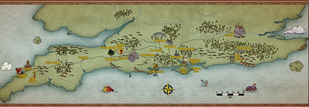
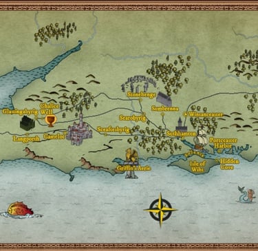
Today, I’m excited to announce the launch of a new Maps page on the website. This feature is designed to help readers better understand the various locations mentioned throughout the stories—especially since many of the cities use their 11th‑century names. I hope this new resource brings clarity and enhances your exploration of the world.
Enhancing Storytelling with Visual Aids
Visual aids play a significant role in storytelling. The newly launched maps page is designed to complement articles by giving readers a geographical perspective of the places featured in my content. By integrating maps, I aim to bridge the gap between a narrative's description and its real-world counterparts, allowing readers to visualize the stories better.
How to Use the Maps Page
Navigating our maps page is straightforward. Once you access the section, you will find two small maps that pinpoint key locations associated with my stories. There is also a larger map that shows everything at once. I believe this feature will help you appreciate the settings of my stories on a deeper level.
I thought you might like to know that the maps were created using Wonderdraft, a wonderful tool with lots of flexibility. I decided to bring some color into the world rather than stick with the classic black‑and‑white look that Tolkien used.
I’d love to hear your thoughts on the Maps page. As the website evolves, your feedback helps me make it more helpful and enjoyable.